
Counties
-
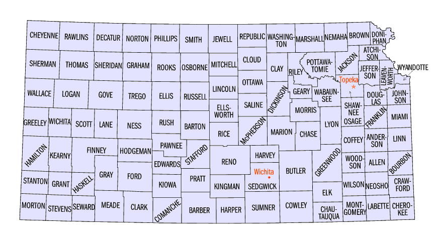
Kansas Facts: Washington County Facts
Washington County is fifth in the first tier of counties stretching west from the Missouri River. To the north lay Jefferson and Gage counties, Nebraska; east, Marshall County; south, Riley and Clay counties; west, Republic and Cloud. Washington County is embraced within that fertile territory which lies between the Blue and Republican rivers as they flow southeast into the Kansas River. The Little Blue River pays most particular attention to Washington County, draining, with its branches, all except its southwestern portions.
-
Kansas Facts: Wichita County Facts
Wichita County was organized on December 24, 1886, by George Edwards; Edward Rhoades; Lilburn Moore; R. E. Jenness; S. W. MCall; and W. D. Brainard. Named for the Wichita Indians, the county contains the city Leoti.
-
Kansas Facts: Wilson County Facts
Wilson County takes its name from Col. Hiero T. Wilson, a resident of Fort Scott since 1843, and a man of prominence in the early days of the Territory. Of the pre-territorial existence of this part of the State but little record exists, and the places mentioned in the record of early travels are generally too vaguely described to admit of identification. In the journal of Capt. Z. M. Pike, of Pike's Peak fame, who passed up the Verdigris on his exploring tour from St. Louis to the headwaters of the Arkansas, appear some interesting passages, which have been already quoted in John S. Gilmore's admirable history of this county.
-
Kansas Facts: Woodson County Facts
Woodson County takes its name from Gov. Silas Woodson, of Missouri. When, however, this honor was conferred on the unknown and unsettled tract in the third tier of counties west of the State line, the space designated by the Legislature contained little if any of the territory which now bears this name. To understand this matter, it is necessary to go back to 1855 and the proceedings of the famous "bogus Legislature."
-
Kansas Facts: Wyandotte County Facts
Wyandotte county, the smallest in the State, lies mainly between Kansas and Missouri Rivers, as they approach each other to make a juncture at the city of Wyandotte. With the exception of Shawnee Township which lies south of the Kaw River the county is in the general shape of a triangle. It is bounded west and north by Leavenworth County northeast to the south by the Missouri River. and southeast by the Kansas River Johnson County lies to the south of Shawnee Township. Wyandotte County contains an area of but 153 square miles.
-
Kansas Local History
This category section contains history and information about the various counties,towns and cities of the state of Kansas.
-
Wichita Kansas History
Wichita,Kansas is the county seat of Sedgwick County, lies on tablelands at the confluence of the Arkansas and Little Arkansas Rivers. A fifth of the city is built west of the Arkansas River; a smaller fraction lies on the tongue of land between the junction of the rivers. The rest of Wichita sprawls east of the rivers, its north-south bulk bisected by a drainage canal. The city is closely knit by concrete bridges, six of which span the Arkansas, eight the Little Arkansas, and twenty-four the drainage canal.